Bahariya Oasis Travel Guide
About the City Bahariya Oasis
Nestled in a dramatic and vast depression, Bahariya Oasis is a captivating gem in Egypt’s Western Desert. Known historically as the ‘Northern Oasis’, this 100km by 40km haven is cocooned by towering black escarpments. Located a mere 365km from Cairo, Bahariya offers an accessible glimpse into a unique desert landscape.
Bahariya‘s existence is a testament to the ancient courses of the Nile. Thousands of years ago, this was the river’s path, long before the emergence of Nile civilizations. The oasis’s water, bubbling up from deep underground wells, is a remnant of that era. Initially viewed as a plentiful resource, substantial investments were made in the area. However, research later revealed these reserves were more finite, estimated to last just a century under current exploitation. This led to the abandonment of grand development plans, leaving Bahariya, and particularly its largest village Bawiti, bearing the scars of these unfulfilled promises.
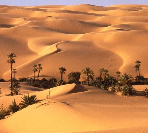
The oasis itself is a picturesque blend of date palm forests, refreshing springs, and a landscape dotted with conical hills, remnants of a prehistoric lake. The fertile valley floor, enriched by ancient springs, tells a story of a time when Bahariya was a vital agricultural hub. In the Pharaonic era, it was renowned for producing wine that reached the Nile Valley and even Rome. Its strategic location along caravan routes from Libya to the Nile Valley fostered prosperity through various historical epochs.
Recent archaeological discoveries, like the Golden Mummies, and proximity to the mesmerizing White and Black Deserts, have solidified Bahariya’s position as a must-visit destination for travelers.
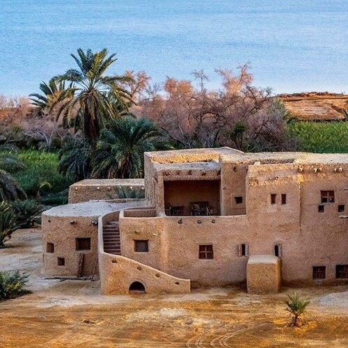
The oasis comprises several villages, with El Bawiti at its heart, serving as the administrative center. Nearby are the villages of Qasr, Mandishah, El-Zabu, and the smaller el-‘Aguz. Further east lies Harrah, and to the south, El Hayz, a site of significant mummies, sometimes considered distinct due to its distance from the main cluster of settlements.
The transformation of transportation, notably the advent of 4×4 vehicles and improved roads, has brought Bahariya closer to the rest of Egypt. It’s now just a few hours’ drive from Cairo, making it an ideal destination for short getaways.
The culture of Bahariya is a rich tapestry woven from the descendants of ancient inhabitants, Bedouin tribes from Libya, and settlers from the Nile Valley. The Waḥātī people, as they are known, are predominantly Muslim, and their social life is deeply rooted in Islamic traditions.
Music plays a pivotal role in the cultural fabric of Bahariya. Traditional instruments like flutes, drums, and the simsimeyya resonate at social gatherings, especially weddings. Folk songs, passed down through generations, remain alive alongside contemporary music from Cairo and beyond, reflecting the oasis’s evolving yet grounded cultural identity.
Created On March 18, 2020
Updated On July 24, 2025