No other nation in the world says ‘Welcome’ as often as the Egyptians, and every time, they mean it. While the ancient civilization of Egypt continues to amaze, contemporary Egyptians are equally remarkable.
Farafra Oasis Travel Guide
Farafra Oasis
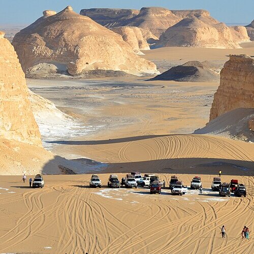
The Farafra Oasis, a lush haven in Egypt’s mystical Western Desert, presents a stunning contrast to the surrounding arid landscapes. Shaped like a triangle, it lies strategically between the Dakhla and Bahariya oases, graced by the formidable Great Sand Sea to the west. This location, approximately midway between Dakhla and Bahariya, adds a geographic charm to Farafra, making it a vital waypoint in the desert.
Historical Legacy
Steeped in history, Farafra was once part of the ‘New Valley’ project or Wadi el-Gedid since 1958. Its ancient name, Ta-iht, translates to the ‘Land of the Cow,’ hinting at its past connections with the cow-headed goddess Hathor, a symbol of nurturing and protection. This oasis, the largest depression in the Libyan Desert, stretches around 200 km in length and 90 km in width at its broadest point, Qasr el-Farafra. Despite its current low population, the Egyptian government’s ambitious development plans are set to transform Farafra, shifting its identity from a remote oasis to a thriving community center.
Population and Agriculture
In recent years, Farafra has seen its population grow to over 20,000, mostly immigrants from the Nile Valley drawn by agricultural prospects. A noteworthy agricultural initiative near Bir Qarawein has revolutionized over 10,000 hectares, turning them into productive farmland and marking a significant milestone in Farafra’s evolution.
Infrastructure and Connectivity
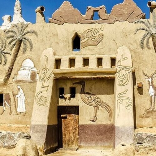
Traveling to Farafra was once a formidable challenge, with rough, unpaved routes from other oases and the Nile Valley. However, the introduction of a well-developed road network has greatly improved access, connecting Farafra with other Western Desert oases and facilitating smoother travel. The city of Qasr Farafra, the capital of the Farafra Oasis and its most ancient settlement, has evolved significantly from its 19th-century status as the sole inhabited city in the Western Desert.
Tourist Haven
Farafra is increasingly gaining fame as a tranquil tourist destination. Its quiet, warm weather is a major draw for visitors, especially those from North America and Europe looking to escape their colder climates. The oasis offers not just a respite from the cold but an immersive experience into the wonders of the Western Desert, inviting travelers to a world where serenity and ancient history coalesc
Created On March 18, 2020
Updated On Aug , 2024
FARAFRA Travel Guide