No other nation in the world says ‘Welcome’ as often as the Egyptians, and every time, they mean it. While the ancient civilization of Egypt continues to amaze, contemporary Egyptians are equally remarkable.
Visiting tips
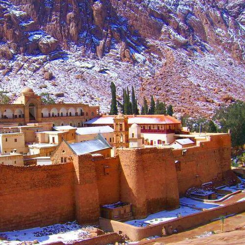
Visiting Tips and Weather Guide for Sainte Catherine, Egypt
Overview
When considering visiting tips for Sainte Catherine, it's essential to understand its unique weather patterns. Sainte Catherine is situated at a high altitude, which significantly influences its climate, differentiating it from the coastal and lower elevation areas of Egypt.
1. Average Temperature Ranges
Winter (December to February):
- Daytime temperatures average between 10°C to 15°C.
- Nighttime temperatures can drop below 0°C, especially in January.
Spring (March to May):
- Daytime temperatures gradually increase, ranging from 15°C to 25°C.
- Nighttime temperatures range from 5°C to 10°C.
Summer (June to August):
- Daytime temperatures hover around 25°C to 30°C.
- Nighttime temperatures are cooler, around 15°C to 20°C.
Autumn (September to November):
- Daytime temperatures decrease to between 20°C to 25°C.
- Nighttime temperatures can fall to 10°C to 15°C.
2. Seasonal Weather Variations
- Winter: Cold, especially at night, with occasional snowfall.
- Spring: Mild and pleasant, with the landscape turning green and vibrant.
- Summer: Warm but not as hot as the rest of Egypt, with clear skies.
- Autumn: Similar to spring, with cooler temperatures and occasional rain.
3. Best Months to Visit
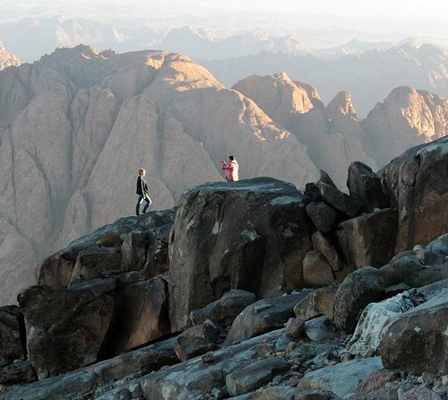
Considering heat, rainfall, and wind, the best months for visiting Sainte Catherine are March to May and September to November. These months offer pleasant weather conditions ideal for exploring the outdoors and visiting the iconic Mount Sinai.
4. Clothing and Gear Recommendations
- Winter: Warm layers, a heavy jacket, gloves, and a hat for the cold nights.
- Spring/Autumn: Light layers for the day and a warm jacket for cooler evenings.
- Summer: Light clothing, a hat, and sunscreen. A light jacket for the evenings.
5. Additional Travel Tips
- Outdoor Activities: The best times for hiking and exploring the natural landscapes are spring and autumn, taking advantage of the mild weather.
- Cultural Events: Check local calendars for any religious or cultural events happening in Sainte Catherine, which are often aligned with favorable weather conditions.
- Altitude Awareness: Due to the high altitude, it’s essential to stay hydrated and give yourself time to acclimatize to avoid altitude sickness Incorporating these visiting tips into your travel planning will ensure a comfortable and memorable experience in Sainte Catherine. The city's weather patterns play a crucial role in the overall experience, making it imperative to choose the right time for your visit based on your preferences for outdoor activities and cultural exploration.
Created On March 18, 2020
Updated On Aug , 2024
ST. CATHERINE Travel Guide